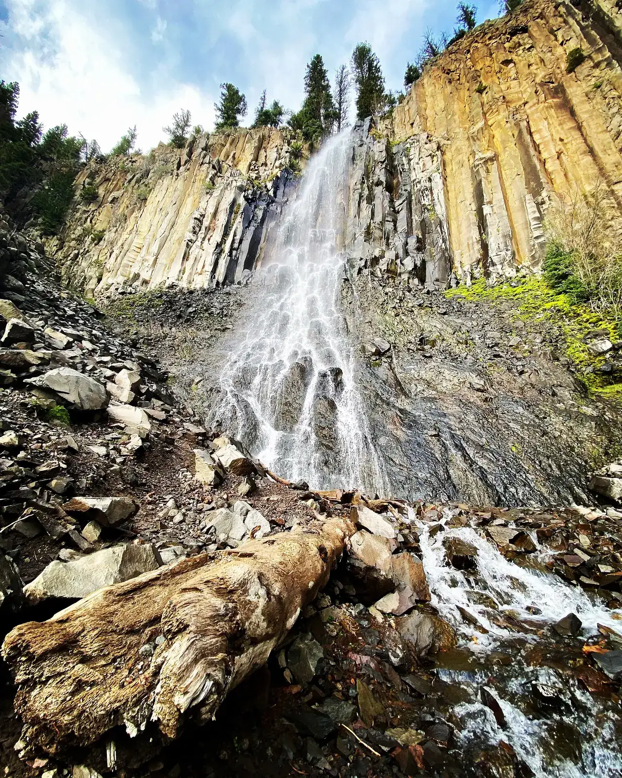
Palisade Falls
🚗 48–68 minHyalite Canyon (East Fork)
- DifficultyEasy (paved, accessible to viewing area)
- Distance~1.1–1.2 mi
- Elevation gain~250–270 ft
Paved half-mile nature trail to a tall waterfall pouring over basalt cliffs; picnic tables and accessible vault toilet.
Season: Late May–Dec (vehicles); winter access on skis/snowshoes after Jan 1
source
Grotto Falls
🚗 ~51 minHyalite Canyon (Hyalite Creek TH, end of main road)
- DifficultyEasy (wide, accessible trail)
- Distance~2.5 mi
- Elevation gain~280–290 ft
Gentle walk up Hyalite Creek to a pretty cascade—great with kids; in winter the area is an ice-climbing hub.
Season: Mid-May–March (road plowed to Grotto lot until Mar 31)
source
Hyalite Peak via Hyalite Creek Trail #427
🚗 ~51 minHyalite Canyon
- DifficultyStrenuous (full day, 8–9 hrs)
- Distance~15 mi
- Elevation gain~3,250–3,500 ft
Classic 'waterfall trail' passing Grotto, Silken Skein and many more falls and on to the Hyalite Peak summit with big views.
Season: July–September (snow often lingers into mid-July)
source
College 'M' Trail
🚗 18–19 minBridger foothills (MT-86)
- DifficultyModerate–steep (short)
- Distance~1 (steep route) / longer switchback route available mi
- Elevation gain~750 ft
Bozeman's signature quick hike to the giant white 'M' with views over the Gallatin Valley.
Season: Year-round (icy in winter—traction recommended)
source
Drinking Horse Mountain
🚗 19–20 minBridger Canyon (across from the M)
- DifficultyModerate
- Distance~2.1–2.3 (loop) mi
- Elevation gain~700 ft
Forested switchback loop with valley and Bridger Range viewpoints—quieter than the M.
Season: Year-round
source
Sypes Canyon Trail
🚗 17–22 minNorth Bridger foothills
- DifficultyModerate
- Distance~4–6.8 depending on turnaround mi
- Elevation gain~1,600–1,850 ft
Forest drainage climb to a popular overlook (~2 mi) and on to the Bridger Foothills Trail (~3.1 mi); the closest real mountain hike to Belgrade.
Season: Spring–fall (usable in winter with traction)
source
Lava Lake (Cascade Creek Trail)
🚗 32–34 minGallatin Canyon (US-191)
- DifficultyModerate
- Distance~5.2–6 mi
- Elevation gain~1,600 ft
Steady climb along Cascade Creek to a striking mountain lake—one of the area's most popular hikes (busy on weekends).
Season: June–October
source
Storm Castle Peak
🚗 ~40–45 minGallatin Canyon (Storm Castle Rd)
- DifficultyStrenuous (steep switchbacks)
- Distance~5 mi
- Elevation gain~1,800–2,300 ft
Short but steep climb to a rocky summit with a bird's-eye view down the Gallatin Canyon.
Season: May–October
source
Ousel Falls
🚗 54–60 minBig Sky
- DifficultyEasy
- Distance~1.6 mi
- Elevation gain~150–400 (sources vary) ft
Well-built family trail in Big Sky to a lovely waterfall.
Season: Year-round
source
Beehive Basin
🚗 68–73 minBig Sky (Moonlight area)
- DifficultyModerate
- Distance~6.6–7.2 mi
- Elevation gain~1,500–1,700 ft
High alpine basin hike near Big Sky; managed jointly by BSCO and the Forest Service.
Season: July–September
source
Sacagawea Peak (from Fairy Lake)
🚗 57–73 minBridger Range
- DifficultyStrenuous (steep)
- Distance~4.3–4.8 mi
- Elevation gain~1,930–2,030 ft
Short, steep route to the 9,665-ft high point of the Bridger Range.
Season: July–September
source
Bridger Ridge (full traverse)
🚗 57–73 minBridger Range – Fairy Lake to the M
- DifficultyVery strenuous / experts only; shuttle needed
- Distance~19.9 one-way (Bridger Ridge Run course) mi
- Elevation gain— ft
The iconic ridgeline of the Bridgers, famous for the annual Bridger Ridge Run; exposed, rocky and long—for fit, experienced hikers.
Season: Late July–September
source
Pine Creek Falls
🚗 60–68 minParadise Valley (Absaroka Range)
- DifficultyEasy–moderate
- Distance~2.4–3.2 mi
- Elevation gain~380–740 (sources vary) ft
Forest walk to a tall waterfall; continue (much steeper) to Pine Creek Lake for a big day.
Season: May–October
source